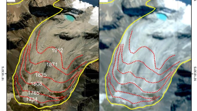
This new PROTECT publication “Using a Web Map Service to map Little Ice Age glacier extents at regional scales” was published in Annals of Glaciology.
Mapping Little Ice Age glacier extents contributes to improved sea-level rise projections. Using high resolution Web Map Services for it is accurate and widely applicable.

Leave a Reply